Gran Sometta, from Euillaz

Edited by:
Massimo Martini
Updated at: 12/07/2026
Access
Road directions
At the Châtillon-Saint-Vincent motorway exit [A5], turn left and continue for 300m (0.3km) until you reach the roundabout; take the third exit onto Via Emilio Chanoux and follow it for 600m (0.9km), passing through the centre of Châtillon. Turn right onto Via L.F. Menabrea and follow it for 450m (1.4km) to the roundabout; take the second exit to join the towards Valtournenche. Follow the for 19.5 km (20.9 km) towards Valtournenche – Breuil-Cervinia, passing through the towns of Antey-Saint-André and Valtournenche. Once past the village of Valtournenche, turn left onto the road to Plan de La Glaea and continue for 450m (21.3km); the car parks are on the left near the lower station of the cable car.
Car park
In Plan de La Glaea, there are three free 🅿️ car parks in the immediate vicinity of the lower station of the Valtournenche–Salette cable car. These car parks are the boarding point for the route.
Access by cable car
Take the Valtournenche-Salette cable car from the lower station at Plan de La Glaea (1,524 m) to the upper station in Euillaz (2,245 m), the starting point of the route. The cable car operates in summer (roughly from late June to early September, 9.00–17.00) and during the winter season; check the latest opening dates and fares on the website Cervino Ski Paradise. Journey time: approximately 12 minutes. When the cable car is closed, access on foot from Plan de La Glaea is possible.
Access by public transport
The route is served by Arriva Italia, route 503, which departs from Châtillon FS and terminates at Breuil-Cervinia; the relevant stop is in the centre of Valtournenche. The Plan de La Glaea valley station cannot be reached directly by public transport and is approximately 1 km from the village.
Distance and journey time
• 🕒 Journey time by road: approx. 37 mins
• 📏 Distance: 21.3 km
• 🕒 Cable car journey time: approx. 12 mins
GPS navigation
• 📍 How to get there with Google Maps
• 📍 How to get there with Apple Maps
Important information
The directions provided were verified on the date the route was mapped. Before setting off, we recommend checking for any changes to the route or road conditions. For up-to-date information, please consult Google Maps or Apple Maps.
Introduction
A round-trip hike to Gran Sometta (3,116 m), an isolated peak situated between Colle Inferiore and Colle Superiore delle Cime Bianche, in the northern part of the Valtournenche ski area. The route starts from the top station of the Valtournenche–Salette cable car in Euillaz. Canon Georges Carrel listed Gran Sometta as the third hike to undertake starting from Breil — the spelling used in 1867 in his guide to Valtournenche to refer to the village now known as Valtournenche.
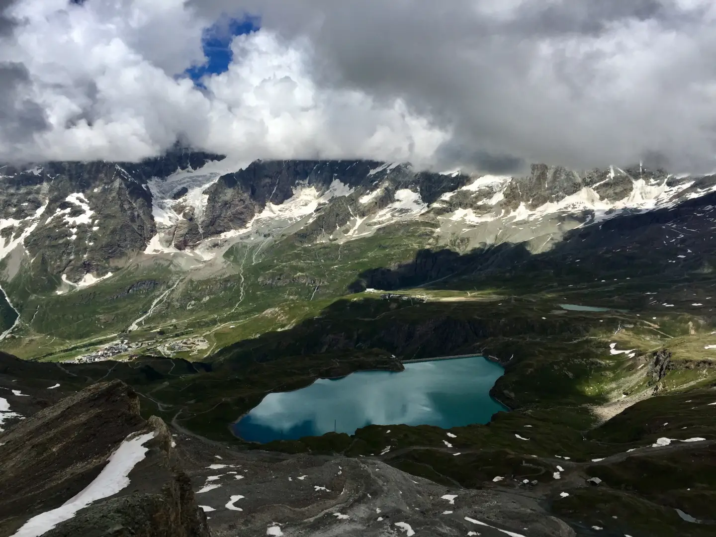
The valley of the Cleyva Groussa stream, which the route follows in its first section, is occupied by the ski lifts of the winter resort. The landscape opens up in the upper section, beyond the Colle Inferiore delle Cime Bianche, where you leave the marked path to follow a track indicated by cairns up a steep slope and over loose ground. From the summit, marked by a small white statue of the Virgin Mary, the view takes in the Matterhorn, the Dent d’Herens, the Grandes Murailles, the Gobba di Rollin and the Breithorn to the west; to the east, the valleys open out towards the Aventine lakes.
The route is accessible during the cable car’s summer operating period, roughly from late June to early September. The summit section requires good visibility to follow the route correctly.
Description
[0h00’T1] 0.00 km Leaving the top station of the cable car at Euillaz, head for the signpost showing the main routes in the area. Continue along the dirt track towards Colle inferiore delle Cime Bianche; once you’ve passed the refreshment bar, turn left onto a track that climbs steeply at the start. Once past the first steep section, continue up a slope that levels out as it runs alongside a water reservoir used for artificial snowmaking; then resume the climb on a steeper gradient until you reach a mountain pasture. Continue through the valley of the Cleyva Groussa stream — the Gran Sometta is visible at the far end of the valley — and, after a couple of hairpin bends, reach the signpost marking the start of the footpath and the end of the dirt track.
[0h25’T2] 0.51km Turn left, cross a small stream and follow the trail – which is not always clearly marked – keeping an eye out for the yellow markings. Pass a stone hut in the immediate vicinity and gradually move to the right across a gently sloping hillside; continue straight on until you reach a junction marked by a signpost (2,364m).
[0h40’T2] 0.95km Climb gradually whilst traversing the grassy slope until you reach the wall of the chairlift’s lower station, marked by signposts (2,424m). Follow the wall to the left and continue across the grassy plateau; just before rounding a grassy ridge, you’ll reach a junction marked by paint marks on the rocks (2,446m).
[1h10’T2] 1.50 km Continue straight on, with a few ups and downs through small hollows and valleys; cross a small grassy plateau and, near a stream, reach a junction marked by a post (2,629m).
[2h00’T2] 2.72km Turn left and continue along the traverse; at the next junction (2,643m), turn right and climb up the wide gully on the left-hand side towards the top station of the lifts at Colle inferiore delle Cime Bianche (2,888m).
[2h50’T3] 3.60 km (625 m elevation gain) (5 m elevation loss) Turn immediately left where a track climbs up to the roof of the ski lift structure; negotiate a steep section and move left onto the slope leading to a shoulder (2,976 m).
[3h15’T3] 3.89km On a slope that temporarily levels out, head along the track and cairns towards the scree slope below the summit. Cross the slope at the base towards the left, then climb diagonally up over loose terrain to a ridge; go just around it and continue with a more challenging climb up the scree-covered flank. On steep, loose terrain, veer right to position yourself below the final slope, which – though short, is steep – leads to Gran Sometta (3,116m) [3h45’T3] 4.35km .
The descent follows the same route taken on the ascent [2h20’T3] 4.35km .
Places of Interest
• Gran Sometta
Collections
• hikes in Valtournenche | list - map
• Hikes starting from Euillaz | list – map
• Hikes in the Aosta Valley | list – map
• Peaks in the Aosta Valley | list – map
Comments (0)
Sign in to leave a comment